

Islands destinationThe Mariana IslandsMicronesia | Pacific Ocean
Last updated on 09/29/2026 at 12:55 AM
The Mariana Islands form a volcanic archipelago in the western Pacific, consisting of 15 main islands stretching for about 500 miles from north to south. The island of Guam, at the southern end, is politically separate from the fourteen northernmost islands that make up the Commonwealth of the Northern Mariana Islands.

View of Tumon Bay on the island of Guam © Michaelfitzsimmons | Dreamstime.com
The archipelago lies in the northern part of Micronesia, east of the Philippines and southeast of Japan. It forms the eastern boundary of the Philippine Sea and lies close to the Mariana Trench, the deepest known point in the world's oceans.
Geographic location
A volcanic archipelago
The Mariana Islands form an arc in the western Pacific. They are the exposed peaks of a chain of underwater volcanic mountains formed by the interaction of major tectonic plates. The northern islands are generally younger and have more prominent volcanic landscapes, while Guam and several southern islands also have limestone terrain formed from ancient reefs.
The archipelago stretches for about 500 miles from north to south. Guam, the southernmost and largest of the Mariana Islands, lies south of Rota, Tinian, and Saipan, the main inhabited islands of the Northern Mariana Islands. Farther north are several uninhabited volcanic islands, including Pagan, Agrihan, Asuncion, and Farallon de Pajaros.
Between the Philippine Sea and the Pacific
The Marianas occupy a unique position in the western Pacific. They lie east of the Philippines and north of the Caroline Islands, while the northern end of the archipelago approaches the Japanese island arc. The archipelago therefore marks the eastern boundary of the Philippine Sea.
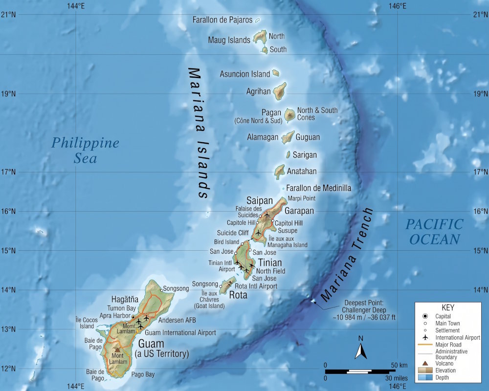
Map of the Mariana Islands in the western Pacific
East of the islands lies the vast Pacific basin and the Mariana Trench. With a depth exceeding 35,800 feet, the Mariana Trench is the deepest known depression in the world's oceans. It is associated with the subduction of the Pacific Plate beneath the Philippine Sea Plate and reflects the intense tectonic activity of this part of the Pacific.
An ancient and turbulent history
The first inhabitants
The Mariana Islands have been inhabited for more than 4,000 years. The first inhabitants, the Chamorro people, developed a distinctive island society adapted to the land and marine resources of the archipelago. Archaeological remains testify to the long history of human settlement and to the mastery of navigation in this part of the Pacific.
Chamorro culture remains deeply rooted in the Marianas today. Traditions, language, cuisine, and many elements of the cultural heritage reflect this ancient history, despite the profound changes brought about by several centuries of foreign rule.
From Spain to the United States
Navigator Ferdinand Magellan reached Guam in 1521 during his voyage around the world, marking the beginning of documented contact between the Marianas and Europeans. Spain subsequently took control of the archipelago and established a lasting presence there. The Marianas later came under German administration at the end of the 19th century, followed by Japanese administration after World War I.
World War II had a profound impact on the islands, particularly Saipan, Tinian, and Guam. After the conflict, the political paths of Guam and the Northern Mariana Islands diverged. Guam remained a U.S. territory, while the Northern Mariana Islands became a commonwealth in political union with the United States in 1978.
Volcanic and marine landscapes
Islands with contrasting landscapes
The landscapes of the Marianas are directly linked to their volcanic origins. The southern islands, such as Guam, Rota, Tinian, and Saipan, combine forested hills, cliffs, beaches, and limestone plateaus, while the more northern islands feature volcanoes and much wilder landscapes. Some northern islands are uninhabited and difficult to access.


This geological diversity is also found along the coast and beneath the water's surface. Coral reefs, lagoons, cliffs, and volcanic seafloors provide habitats for a wide variety of marine species. The waters around the islands are also visited by sea turtles, dolphins, whales, sharks, and numerous reef fish.
Protected natural sites
The three northernmost islands, Farallon de Pajaros, the Maug Islands, and Ascension Island, are part of the Marianas Trench Marine National Monument. This vast marine area protects underwater volcanoes, deep-sea habitats, and the waters surrounding these remote islands.
The region has exceptional geological activity. The Mariana Trench, underwater volcanoes, and hydrothermal vents are evidence of processes that are still continuing today. The depths and isolation of this part of the Pacific also support rare marine species and others that remain poorly known.
Guam and the Northern Mariana Islands
Two U.S. Territories
The Marianas are now divided between two U.S. territories. Guam, at the southern end of the archipelago, is an unincorporated U.S. territory under American sovereignty. The fourteen islands farther north form the Commonwealth of the Northern Mariana Islands, a U.S. territory with its own government.
This political organization explains some of the differences between the two parts of the archipelago. Guam is the largest and most populated of the Mariana Islands and has extensive air, port, and tourism infrastructure. In the Northern Mariana Islands, Saipan is home to much of the population and economic activity, while Tinian and Rota offer a quieter environment.
Very different islands
The island of Saipan is known for its beaches, lagoons, and numerous historic sites associated with World War II. Tinian also has an important historical heritage and large areas of natural landscape, while Rota is known for its forested scenery, cliffs, and more preserved character.
Farther north, the islands become increasingly isolated. Some, such as Pagan, have vast volcanic landscapes but have remained uninhabited since eruptions in the 20th century. These northern islands are very different from the tourist areas of Guam and Saipan, with more difficult access and limited infrastructure.
A heritage shaped by World War II
The 1944 Battles
The Marianas played an important role in the history of World War II in the Pacific. In 1944, U.S. forces launched a major offensive against Japanese positions on Saipan, Tinian, and Guam. The fighting caused heavy casualties among military personnel and civilians.
On Saipan, the American Memorial Park honors those who died during the Marianas campaign. The island also preserves numerous remains from this period, including military positions, bunkers, and shipwrecks. Tinian, for its part, retains traces of the major air base used by U.S. forces toward the end of the war.
Visible remains
Traces of military history are still numerous throughout the Mariana Islands. Some have become memorial sites, while others lie amid natural landscapes, sometimes close to beaches or cliffs.
This heritage complements the other chapters of the islands' history, from ancient Chamorro traditions to the Spanish, German, and Japanese periods. Exploring the Marianas therefore brings together cultural heritage, Pacific history, and tropical landscapes.
Practical Information
Two Capitals
The two parts of the archipelago have their own administrative systems. Hagåtña is the capital of Guam, while Saipan is the capital of the Commonwealth of the Northern Mariana Islands. Saipan is also the territory's main administrative and economic center.
The U.S. dollar is used in both territories. Guam has more developed tourism and transportation infrastructure, while transportation options and services can be more limited on the smaller islands of the Northern Mariana Islands.
Getting Around the Islands
Distances between the islands and the frequency of connections vary greatly depending on the destination. Guam and Saipan have the main air transportation infrastructure, while Tinian and Rota can be reached from Saipan by regular interisland flights. The more northern islands are much more isolated, and some have no regular tourist connections.
If you want to explore several islands, it is therefore best to plan your itinerary around the available connections rather than treating the archipelago as a single destination that can be easily explored. Weather conditions can also affect travel, particularly in the more remote islands.
How to get there ?
By Air
The Mariana Islands are primarily accessible by air. Saipan, the largest of the Northern Mariana Islands, is the main gateway to this part of the archipelago. Direct and connecting flights link Saipan with destinations including Guam, Japan, South Korea, and Hong Kong. Air connections can vary depending on the season and the airlines.
At the southern end of the archipelago, Guam is home to Antonio B. Won Pat International Airport and is an important hub in the western Pacific. Direct flights connect Guam with several major Asian cities, including Tokyo, Seoul, Manila, and Taipei.
Getting Around the Islands
Once in Saipan, travelers can continue to Tinian and Rota via interisland flights. These three islands make up the main tourist area of the Northern Mariana Islands and can therefore be combined during the same trip.
The more northern islands are much more isolated and do not have the same regular connections. If you are planning a trip that combines several islands, it is important to check flight schedules before building your itinerary and to allow enough time for connections. Weather conditions can also disrupt travel in this part of the Pacific.
The Mariana Islands in Numbers
- Area: 184 sq mi for the Northern Mariana Islands and 212 sq mi for the island of Guam
- Population: 225 468 inhabitants (2024), including 176 737 on the island of Guam alone and 48 731 in the Northern Mariana Islands
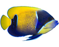
The marine species in Micronesia

The Mariana Islands
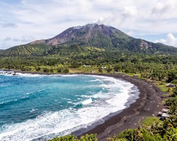
Northern Mariana islands
Micronesia

Caroline islands
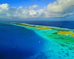
Marshall islands
The islands from pacific Ocean

Alcatraz island
Grande Terre island

Hatta island

Japan islands

Komodo island
Moorea island
Rimatara island
Vanua Levu island
Explore new islands
Andros island
Dry Tortugas islands
Hvar island
Koufonissi island

Milos island

Mykonos island

Paradise island
Sicily island
Our latestUpdates
The neon gobyDiscover the neon goby (Elacatinus oceanops), a small western Atlantic reef fish known for its brilliant blue stripe and its role as a cleaner fish that removes parasites from other fish.Read more
The poison gobyDiscover the poison goby (Gobiodon citrinus), a tiny reef fish with a bright yellow body and distinctive blue markings. It lives among branching Acropora corals in the tropical waters of the Indo-Pacific.Read more
The wahooDiscover the wahoo (Acanthocybium solandri), a powerful pelagic predator found in tropical and subtropical oceans. Recognizable by its streamlined body and distinctive blue vertical stripes, it is a fast swimmer that feeds mainly on fish and squid.Read more
Photo of the Day

Fou à pieds rouges
(Sula sula)
(Sula sula)
 Copyright © 2007-2026 auxBulles.com - All rights reserved. Legal notices.
Photo credits - Our partners